♦ Brecon Beacons Nationaal Park
 Wandelgids 018 Pathfinder Guides Brecon Beacons | Ordnance Survey
Wandelgids van een deel van Engeland. Deze gids bevat 28 dagwandelingen, variërend van korte tochten tot pittige dagtochten. De bijbehorende kaarten zijn uitstekend: men heeft de topografische kaarten van Ordnance …
★★★★★ Wandelkaart - Topografische kaart OL12 OS Explorer Map Brecon Beacons NP West | Ordnance Survey
Een van de beste detailkaarten die er op de wereld gemaakt worden: zeer gedetailleerd, prachtig helder kleurgebruik, veel topografische aspecten en - zeer belangrijk - allerlei toeristische en recreatieve aspecten …
★★★★★ Wandelkaart - Topografische kaart OL13 OS Explorer Map Brecon Beacons NP East | Ordnance Survey
Een van de beste detailkaarten die er op de wereld gemaakt worden: zeer gedetailleerd, prachtig helder kleurgebruik, veel topografische aspecten en - zeer belangrijk - allerlei toeristische en recreatieve aspecten …
★★★★★ Wandelkaart - Topografische kaart 160 Landranger Brecon Beacons - Wales | Ordnance Survey
Zeer goede detailkaart met topografische ondergrond. Kleurgebruik is goed over nagedacht: bijzonder goed leesbaar en helder kaartbeeld. Hierop zijn toeristische symbolen van bezienswaardigheden ingetekend, daarnaast staan bijvoorbeeld campings en jeugdherbergen …
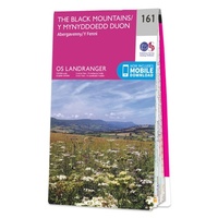 Wandelkaart - Topografische kaart 161 Landranger Abergavenny & The Black Mountains/Y Mynyddoedd Duon - Brecon Beacons / Wales | Ordnance Survey
Zeer goede detailkaart met topografische ondergrond. Kleurgebruik is goed over nagedacht: bijzonder goed leesbaar en helder kaartbeeld. Hierop zijn toeristische symbolen van bezienswaardigheden ingetekend, daarnaast staan bijvoorbeeld campings en jeugdherbergen …
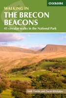 Wandelgids Walking on the Brecon Beacons | Cicerone
Uitstekende wandelgids van dit geweldige gebied. goed beschreven met veel praktische informatie om de route te kunnen lopen, inclusief redelijke kaarten. Guidebook to 45 graded circular walks in the Brecon …
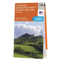 Wandelkaart - Topografische kaart 186 OS Explorer Map Llandeilo, Brechfa Forest | Ordnance Survey
Met zijn 4cm voor 1 km (2 ½ cm voor 1 mijl) schaal, is de OS Explorer kaartenserie de ideale en meest gedetailleerde kaartenreeks voor mensen die graag outdoor-activiteiten zoals …
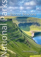 Wandelgids Brecon Beacons | Northern Eye Books
This good looking, modern walking book will take you on ten short circular themed walks across South Wales’ ever-popular Brecon Beacons National Park. The Brecon Beacons was Britain’s 10th …
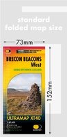
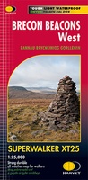 Wandelkaart Brecon Beacons West | Harvey Maps
Includes Pen y Fan, Foel Fraith, Fan Fawr and Fan Gyhirych. Detailed map for hillwalkers of the western part of the Brecon Beacons National Park at the popular scale …
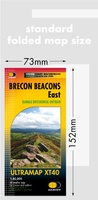
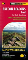 Wandelkaart Brecon Beacons Oost | Harvey Maps
Includes Pen y Fan and the Black Mountains. Detailed map for hillwalkers of the western part of the Brecon Beacons National Park at the popular scale of 1:25,000. …
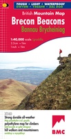 Wandelkaart Brecon Beacons | Harvey Maps
"The Brecon Beacons have an irresistible draw and this is where I began my journey to the roof of the world. The breathtaking landscape provides challenges and adventures for all …
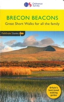 Wandelgids 031 Pathfinder Short Walks Brecon Beacons | Ordnance Survey
Wandelgids van een deel van Wales. Deze gids bevat 20 wandelingen, geschikt voor de hele familie. De bijbehorende kaarten zijn uitstekend: men heeft de topografische kaarten van Ordnance Survey gebruikt …
 Fietsgids Cycling Lon Las Cymru | Cicerone
Guidebook to cycling Lôn Las Cymru, a 255 mile (410km) route from Cardiff, or 242 mile (390km) from Chepstow to Holyhead, showcasing Wales's beautiful rural heartland. Passing through the Brecon …
 Wandelkaart 160 Landranger Active Brecon Beacons | Ordnance Survey
Zeer goede detailkaart met topografische ondergrond. Hierop zijn toeristische symbolen van bezienswaardigheden ingetekend, daarnaast staan bijvoorbeeld campings en jeugdherbergen vermeld en - voor wandelaars het belangrijkst - alle right of …
 Reisgids ANWB Ontdek Wales | ANWB Media
Een nieuwe ANWB reisgids: deze titel is een vertaling van de Duitstalige Dumont reeks. Ze staan bekend als zeer degelijke en behoorlijk complete reisgisden in compact formaat. Met zowel veel …
★★★★★★★★★★ Wegenkaart - landkaart National Park Pocket Map Brecon Beacons | Collins
Handige kleine kaart van dit Nationaal Park. De kaart geeft een goed en helder overzicht van het gebied met alle plaatsen, doorgaande wandelpaden (alhoewel grof van schaal), bezienswaardigheden etc. Met …
 Wandelgids Walking in Carmarthenshire | Cicerone
This guidebook presents 30 contrasting day walks exploring the mountains, valleys and coastline of Carmarthernshire in south-west Wales. Ranging from 2 to 10 miles in length and suitable for walkers …
 Wandelkaart Brecon Beacons Oost | Harvey Maps
Covers a large area yet is handily compact. Pocket perfect! Detailed map for runners and walkers of the eastern part of the Brecon Beacons National Park and the Black …
 Wandelkaart Brecon Beacons West | Harvey Maps
Covers a large area yet is handily compact. Pocket perfect! Detailed map for runners and walkers of the western part of the Brecon Beacons National Park at the magic …
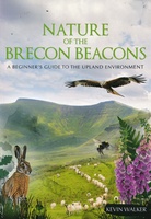 Natuurgids Nature of the Brecon Beacons | Pesda Press
Een gids met de meest voorkomende flora en fauna van de Brecon Beacons. Inclusief beschrijvingen en foto's. For most people wandering through the beautiful landscape of the Brecon Beacons …
Laatste reviews

Kan de huidige ontstuimige ontwikkelingen wereldwijd, nu ook geografisch plaatsen en daarmee beter volgen.
★★★★★ door Leo Janssen 20 december 2024 | Heeft dit artikel gekocht
We hadden Piëmonte al eens bezocht en voor onze komende reis werd ons door kennissen deze gids aanbevolen. Inderdaad is dit een heel goede gids. …
★★★★★ door DWKdB 19 december 2024 | Heeft dit artikel gekocht
Mijn bestellingen zijn altijd goed en worden altijd op tijd geleverd. Komen afspraken goed na. Erg tevreden.
★★★★★ door Ben Wegdam 19 december 2024 | Heeft dit artikel gekocht
Zeer gedetailleerde kaart van het zuidelijke deel van het douaniers pad
★★★★★ door Marian 18 december 2024 | Heeft dit artikel gekocht