Categorieën
- Nieuwe artikelen
- Boeken
-
Kaarten
- Camperkaarten
- Educatieve kaarten
- Fietskaarten
- Fietsknooppuntenkaarten
- Historische Kaarten
- Pelgrimsroutes (kaarten)
- Spoorwegenkaarten
- Stadsplattegronden
- Toerskikaarten
- Topografische kaarten
- Wandelatlassen
- Wandelkaarten
- Wandelknooppuntenkaarten
- Waterkaarten
- Wegenatlassen
-
Wegenkaarten
- Afrika
- Azië
-
Europa
- Albanië
- Andorra
- Armenië
- Azerbeidzjan
- Belarus - Witrusland
- België
- Bosnië - Hercegovina
- Bulgarije
- Cyprus
- Denemarken
- Duitsland
-
Engeland
- North East England
- ♦ Northumberland National Park
- Yorkshire and the Humber
- ♦ Yorkshire Dales Nationaal Park
- ♦ North York Moors Nationaal Park
- North West England
- ♦ Lake District Nationaal Park
- ♦ North Pennines AONB
- 🥾 Hadrian's Wall Path
- East Midlands
- West Midlands
- ♦ Peak District Nationaal Park
- Wales
- ♦ Pembrokeshire Coast National Park
- ♦ Snowdonia Nationaal Park
- ♦ Brecon Beacons Nationaal Park
- East of England - East Anglia
- South West England
- Dorset
- ♦ Cotswolds AONB
- ♦ Devon - Cornwall
- 🥾 South West Coast Path
- ♦ New Forrest National Park
- ♦ Dartmoor National Park
- ■ Bristol
- South East England
- ♦ Kent
- ♦ South Downs Nationaal Park
- ♦ Isle of Wight
- ■ Londen
- ■ Oxford
- Kanaaleilanden
- ♦ Guernsey
- ♦ Jersey
- Estland
- Faroer
- Finland
- Frankrijk
- Georgië
- Griekenland
- Groenland
- Hongarije
- IJsland
- Ierland
- Italië
- Kosovo
- Kroatië
- Letland
- Liechtenstein
- Litouwen
- Luxemburg
- Malta
- Moldavië
- Monaco
- Montenegro
- Nederland
- Noord-Ierland
- Noord-Macedonië
- Noorwegen
- Oekraïne
- Oostenrijk
- Polen
- Portugal
- Roemenië
- Rusland
- Scandinavië
- Schotland
- Servië
- Slovenië
- Slowakije
- Spanje
- Tsjechië
- Turkije
- Vaticaanstad
- Zweden
- Zwitserland
- Midden-Amerika
- Midden-Oosten
- Noord-Amerika
- Oceanië
- Wereld
- Zuid-Amerika
- Wintersportkaarten
- Opruiming
- Puzzels
- Travel Gadgets
- Wandkaarten
- Wereldbollen
Veilig online betalen
Betaal veilig via uw eigen bankomgeving
- U bent hier:
- Home
- Europa
- Engeland
- Kaarten
- Wegenkaarten
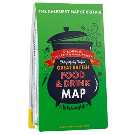
Wegenkaart - landkaart Great British food & drink Map | Ordnance Survey (9781999784560)
- ISBN / CODE: 9781999784560
- Editie: 17-06-2019
- Aantal blz.: 1
- Schaal: 1:25000
- Uitgever: Ordnance Survey
- Soort: Wegenkaart
- Serie: OS
- Taal: Engels
- Hoogte: 24.0 cm
- Breedte: 13.0 cm
- Gewicht: 120.0 g
- Bindwijze: -
- Uitvoering: Papier
- Schrijf als eerste een review
-
€ 27,95
Dit artikel is (tijdelijk) niet leverbaar Dit artikel is (tijdelijk) niet leverbaar
- Afbeeldingen
- Inkijkexemplaar
Beschrijving
Van de uitgever
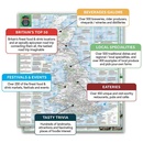
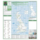
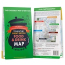
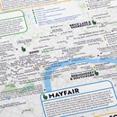
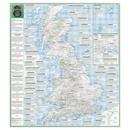
The Cheesiest map of Great Britain, brought to you by Marvellous Maps. Bursting full of over 2,000 food and drink locations, with a generous taste of trivia, this map will have you lusting after the variety of cuisine the Isles have to offer.
Between Paddington's famous marmalade sandwiches to sandy seaside picnics, Britain has had a strange love affair with food.
Discover all the best traditional dishes, local specialities and eateries, Great Britain has to offer with this double-sided map. It doesn't matter if you love sweet or savoury foods, you can use the extraordinary key symbols to find all the cake, cheese, and tea you'll ever need.
Expand your knowledge of British cuisine and get inspired for a food filled journey.
Reviews
Geen reviews gevonden voor dit product.
Schrijf een review
Graag horen wij wat u van dit artikel vindt. Vindt u het goed, leuk, mooi, slecht, lelijk, onbruikbaar of erg handig: schrijf gerust alles op! Het is niet alleen leuk om te doen maar u informeert andere klanten er ook nog mee!
Ook interessant voor europa/engeland
-

Spoorwegenkaart The British Isles by
€ 19,50Spoorwegenkaarten Engeland -

Reisverhaal Te hooi en te gras | Ger
€ 21,99Reisverhalen Engeland -

Reisgids Wild Swim Britain | Guardia
€ 20,95Reisgidsen Engeland -

Wandelgids Running Challenges in Eng
€ 27,95Wandelgidsen Engeland -

Stadsplattegrond Londen miniguide |
€ 8,95Stadsplattegronden Engeland

