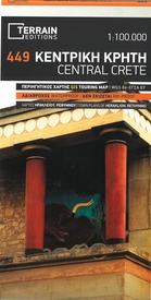
Wandelkaart - Fietskaart - Wegenkaart - landkaart 449 Central Crete - Kreta centraal | Terrain maps (9789609456678)
- ISBN / CODE: 9789609456678
- Editie: 20-06-2018
- Aantal blz.: 1
- Schaal: 1:100000
- Uitgever: Terrain maps
- Soort: Fietskaart, Wandelkaart, Wegenkaart
- Taal: Engels, andere talen
- Hoogte: 25.0 cm
- Breedte: 13.0 cm
- Gewicht: 76.0 g
- Uitvoering: Scheur- en watervast
- Bindwijze: -
- Beoordeling: 3,0 ★★★★★ (1 review) Schrijf een review
-
€ 12,50
Op voorraad. Voor 17.00 uur op werkdagen besteld, binnen 1 tot 2 werkdagen in huis in Nederland Levertijd Belgie
Gratis verzending in Nederland vanaf €35,-
Beschrijving
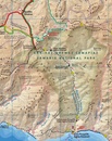
Gedetailleerde wegenkaart en wandelkaart met alle kleine wegen, wandelpaden, hoogtelijnen en toeristische informatie aangegeven. Alle tekst is tweetalig in Engels en Grieks en de waterproof kaart is geschikt voor gebruik met GPS.
- Scale of 100.000, which attributes all the information with clarity and in detail.
- Map data processed within a GIS environment, resulting in great accuracy.
- Double coordinate system, WGS 84 and ΕΓΣΑ 87, completely compatible with GPS.
- It is printed on Polyart material, making it totally waterproof and rip-proof. You can fold it and unfold it a hundred times, fold it in irregular ways, dunk it in the sea or leave it out in the rain. This map is indestructible!
- Clear symbols, easily readable fonts, rich colors and excellent arrangement of every element make the map extremely friendly to the user.
- Unique wealth of information. Every village, every road (including their distance in km), every sight, every beach, every gas station, the camping areas and much more, are all included in the map.
- The most important trails of the area are marked in the map, with clear lines, in two categories (main and secondary trails), including their exact distance in km, as well as the mountain refuges.
- For the first time in a map of Crete, the bolted canyoning routes and the climbing crags of the area are included. Moreover, suggested scenic routes are marked with a green shadow on the map. Also, a full index of the place names and the archaeological sites is included, as well as a detailed townplan of Heraklion in the scale of 1:4.500.
Reviews
Goede bruikbare/leesbare kaart. Vooral handig als je met een quad de kleine weggetjes (off road) wilt rijden. Paar keer vouwen geen slijtage door goede kwaliteit papiersoort.
★★★★★ door e visser 3 oktober 2012Vond u dit een nuttige review? (login om te beoordelen)
Schrijf een review
Graag horen wij wat u van dit artikel vindt. Vindt u het goed, leuk, mooi, slecht, lelijk, onbruikbaar of erg handig: schrijf gerust alles op! Het is niet alleen leuk om te doen maar u informeert andere klanten er ook nog mee!


