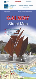
Stadsplattegrond Discovery Galway city | Ordnance Survey Ireland (9781908852731)
- ISBN / CODE: 9781908852731
- Editie: 19-09-2016
- Druk: 6
- Aantal blz.: 1
- Schaal: 1:12000
- Uitgever: Ordnance Survey Ireland
- Soort: Stadsplattegrond
- Serie: Discovery
- Taal: Engels
- Hoogte: 26.0 cm
- Breedte: 11.0 cm
- Gewicht: 96.0 g
- Bindwijze: -
- Uitvoering: Papier
- Schrijf als eerste een review
-
€ 13,95
Leverbaar in 3 - 5 werkdagen in huis in Nederland Levertijd Belgie
Gratis verzending in Nederland vanaf €35,-
Beschrijving
Van de uitgever
Galway on an indexed street plan at 1:12,000 from Ordnance Survey of Ireland with an enlargement showing the city centre in greater detail.Street index, placed under the main map, which lists streets with their names in both Irish and English.
OSI street plans highlight main traffic arteries in each town, national primary and secondary routes, regional roads and main streets, and show one way and pedestrianised streets. Colouring indicates public buildings, highlighting the more important ones, railway/bus stations and medical centres.
A range of symbols indicate various facilities, including An Óige or independent hostels, tourist offices, museums and galleries, shopping centres, sport grounds, etc.
Reviews
Geen reviews gevonden voor dit product.
Schrijf een review
Graag horen wij wat u van dit artikel vindt. Vindt u het goed, leuk, mooi, slecht, lelijk, onbruikbaar of erg handig: schrijf gerust alles op! Het is niet alleen leuk om te doen maar u informeert andere klanten er ook nog mee!


