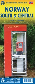
Wegenkaart - landkaart Norway South & Central - Noorwegen Zuid & Midden | ITMB (9781771295796)
- ISBN / CODE: 9781771295796
- Editie: 01-01-2023
- Druk: 1
- Aantal blz.: 1
- Schaal: 1:800000
- Uitgever: ITMB
- Soort: Wegenkaart
- Taal: Engels
- Hoogte: 25.0 cm
- Breedte: 10.0 cm
- Gewicht: 51.0 g
- Uitvoering: Papier
- Bindwijze: -
- Schrijf als eerste een review
-
€ 14,50
Leverbaar in 3 - 5 werkdagen in huis in Nederland Levertijd Belgie
Gratis verzending in Nederland vanaf €35,-
Beschrijving
Van de uitgever
Wegenkaart Noorwegen Zuid & Midden
ITMB recently published a detailed map of the northern half of Norway; now we are pleased to complete our coverage with a lovely, detailed rendition of southern and central Norway. Norway, being such a long country, suffers from an inability to be placed on a map sheet comfortably, so separating it into two double-sided maps provides the cartographer with the opportunity to portray the country at a much better scale than is possible with a map of the entire country. This map starts in Narvik and travels south through Bodo to south of Trondheim on Side 1, showing all the roads and emphasizing the excellent rail connections. A little portion of neighbouring Sweden is shown as well. Side 2 concentrates on the southerly 'bulge'of Norway south to the country and border with Sweden and west to the North Atlantic. A large inset map of Oslo, the capital, is included, as well as a list of Top attractions. Again, both road and rail connections are shown. We try to show tunnels as well, of which there are many. Naturally, touristic sites are included, as well as a selection of camping sites. Longer distance hiking trails/cross-country ski routes are also included. The famous coastal routes of Norwegian ferries is also included, which is an excellent way to view the coastline between Stavanger and Bergen. Map size: 27*39" when unfolded Legend Includes: Roads by classification, Rivers and Lakes, National Park, Airports, Points of Interests, Highways, Main Roads, Zoos, Fishing, and much more...
Reviews
Geen reviews gevonden voor dit product.
Schrijf een review
Graag horen wij wat u van dit artikel vindt. Vindt u het goed, leuk, mooi, slecht, lelijk, onbruikbaar of erg handig: schrijf gerust alles op! Het is niet alleen leuk om te doen maar u informeert andere klanten er ook nog mee!


