Kaarten - Noord-Amerika
 Wegenkaart - landkaart New Orleans - Mississippi River Basin | ITMB
New Orleans stadsplattegrond met schaal 1:15.000, bijzonder uitgebreid. ITMB is pleased to continue its detailed coverage of the USA with its first-ever map of the historic City of New Orleans. …
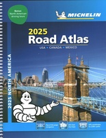 Wegenatlas Road Atlas USA Canada Mexico 2025 | A4-Formaat | Ringband | Michelin
De beroemde wegenatlas van Rand McNally nu als Michelin atlas. Super handige atlas van Michelin in A4 formaat met stevige ringband. Let op: Canada en Mexico staan er zeer beperkt in. …
 Wegenkaart - landkaart Tofino & Southern Vancouver Island | ITMB
Vancouver Island is one of the marvels of tourism in Canada. It is, in fact, so big that it needs to be explored in sections to reach its full potential. …
 Wegenkaart - landkaart Seattle & Washington State | ITMB
This is a new title for ITMB, in that it is the first time we have mapped the State of Washington. The actual area of the map includes Portland and …
 Wegenkaart - landkaart Yellowstone National Park and Wyoming | ITMB
The USA is a vast and wonderful land to explore. ITMB is steadily increasing our coverage of this important travel destination and this month concentrates on the State of Wyoming, …
 Stadsplattegrond City map New York | Lonely Planet
De stadsplattegronden van Lonely Planet zijn uitgevoerd op scheur- en watervast papier, zijn lichtgewicht en kennen een handig formaat. Het centrum van de stad is in heldere kleuren in beeld …
★★★★★ Stadsplattegrond City map Washington DC | Lonely Planet
De stadsplattegronden van Lonely Planet zijn uitgevoerd op scheur- en watervast papier, zijn lichtgewicht en kennen een handig formaat. Het centrum van de stad is in heldere kleuren in beeld …
 Stadsplattegrond City map San Francisco | Lonely Planet
De stadsplattegronden van Lonely Planet zijn uitgevoerd op scheur- en watervast papier, zijn lichtgewicht en kennen een handig formaat. Het centrum van de stad is in heldere kleuren in beeld …
 Wegenkaart - landkaart 3117 Adventure Map Alaska | National Geographic
Wegenkaart van Alaska met vermelding van veel bezienswaardigheden, nationale parken en attrakties. Watervast en scheurvast. Alaska is a land so vast that is boggles the imagination. It is so large …
★★★★★ Wegenkaart - landkaart Banff - Jasper national parks | ITMB
Gedetailleerde wegenkaart van deze 2 bekende nationale parken in Canada. Naast toerischtische informatie zjn de belangrijkste wandelpaden schetsmatig ingetekend en worden de campings weergegeven, hogtelijnen geven een goed beeld van …
★★★★★ Stadsplattegrond City map Boston | Lonely Planet
De stadsplattegronden van Lonely Planet zijn uitgevoerd op scheur- en watervast papier, zijn lichtgewicht en kennen een handig formaat. Het centrum van de stad is in heldere kleuren in beeld …
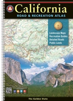 Wegenatlas California Road & Recreation Atlas | A3 Formaat | Ringband | Benchmark Maps
"California is rich in geographical diversity and natural beauty, from its verdant mountains and vast deserts to its seemingly endless Pacific coastline. Get to know the best of California with …
 Wegenkaart - landkaart Jasper National Park (Alberta) | Gem Trek Maps
Waterproof and tear-resistant map for Jasper National Park in the Canadian Rockies. Whether you are a first-time visitor or a long-time local, you’ll find Gem Trek’s Jasper National Park …
 Wegenkaart - landkaart Route 66 | ITMB
Overzichtelijke wegenkaart van een groot gebied. Alles draait om de Route 66 die duidelijk staat ingetekend op deze wegenkaart. Met aanvullende stadsplattegronden (het centrum) van de steden Los Angeles, Flagstaff, …
★★★★★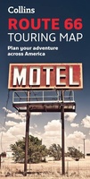 Wandelkaart Touring Maps Route 66 | Collins
Full color, informative map of the famous US Route 66. With detailed mapping, key tourist information and a suggested itinerary, this is a perfect guide for anyone traveling along America’s …
 Wandelkaart 814 Topographic Map Guide Big Sur / Ventana Wilderness /CA | National Geographic
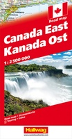 Wegenkaart - landkaart Road maps Canada Oost | Hallwag
 Wandelkaart 101 Topographic Map Guide Cache La Poudre, Big Thompson /CO | National Geographic
 Wandelkaart 505 Topographic Map Guide Moab Greater Region | National Geographic
 Wandelkaart 506 Topographic Map Guide Moab West - Klondike Bluffs, Dead Horse Point /UT | National Geographic
Laatste reviews

Heb de gids cadeau gedaan en die persoon was er heel blij mee ..
★★★★★ door J 21 november 2024 | Heeft dit artikel gekocht
De kaart van Kirgystan is prachtig, zeer gedetailleerd. Kan niet wachten tot de we echt op reis hmgaan die kant op.
★★★★★ door Marijke Eering 21 november 2024 | Heeft dit artikel gekocht
Super handig fiets boekje en mooi water bestendig. En handig om op de kaarten te kijken heel duidelijk beschrijving. Wij fietsen al jaren in Duitsland …
★★★★★ door Jenneke holterman 19 november 2024 | Heeft dit artikel gekocht
prima kaart levering en betaling allemaal vlot verlopen
★★★★★ door Marc Buts 19 november 2024 | Heeft dit artikel gekocht

