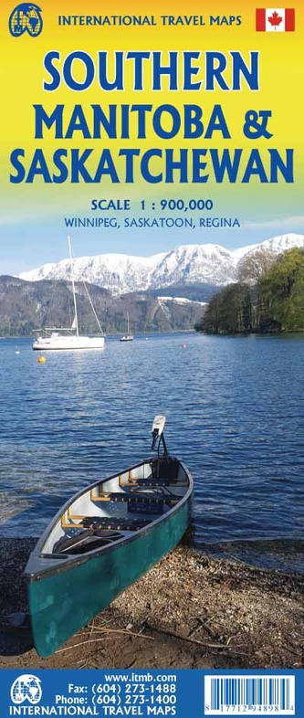
Wegenkaart - landkaart Southern Manitoba & Saskatchewan | ITMB (9781771294898)
- ISBN / CODE: 9781771294898
- Editie: 15-08-2024
- Druk: 1
- Aantal blz.: 1
- Schaal: 1:900000
- Uitgever: ITMB
- Soort: Wegenkaart
- Taal: Engels
- Hoogte: 25.0 cm
- Breedte: 10.0 cm
- Gewicht: 54.0 g
- Bindwijze: -
- Uitvoering: Papier
- Schrijf als eerste een review
-
€ 12,95
Leverbaar in 3 - 5 werkdagen in huis in Nederland Levertijd Belgie
Gratis verzending in Nederland vanaf €35,-
Beschrijving
Van de uitgever
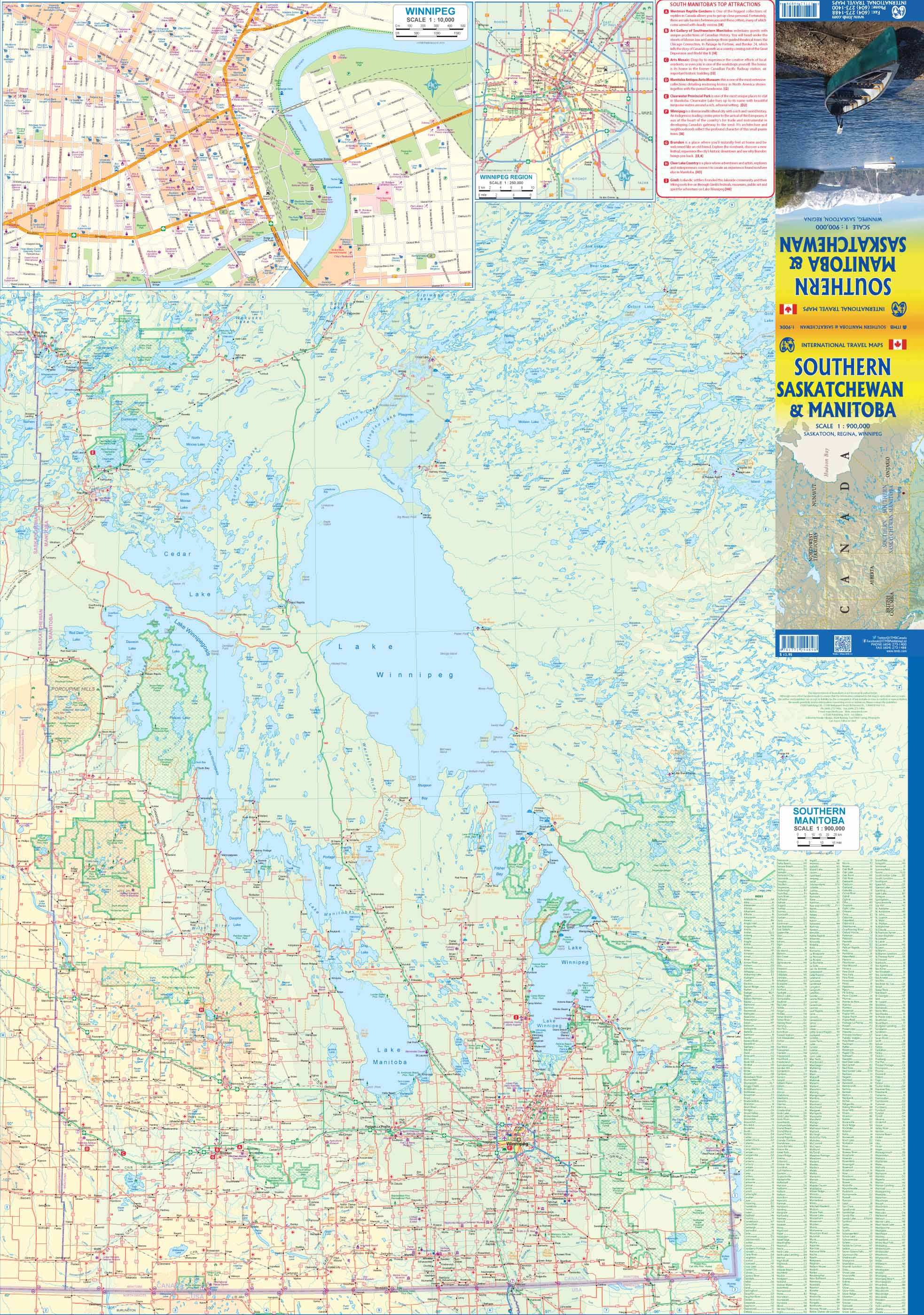
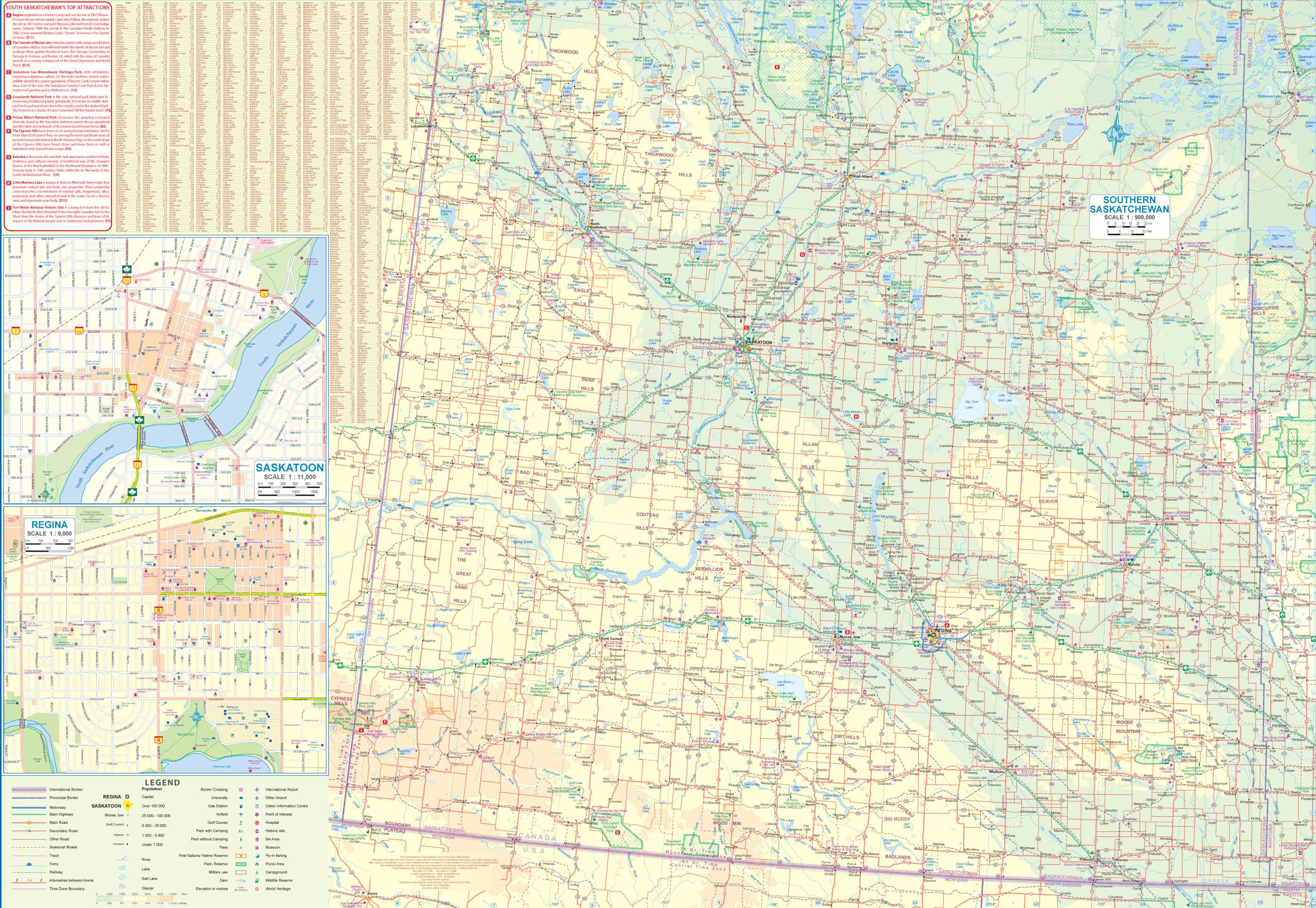
Wegenkaart Manitoba Zuid / Saskatchewan ZuidThis is a new map for ITMB, joining two others in a series of maps covering the southern halves of the western provinces, in this case the prairie provinces of Manitoba and Saskatchewan. Manitoba emerged out of the unsettled west and gained provincial status in 1870, with its capital in Winnipeg. Saskatchewan was settled as a result of the western expansion of the trans-continental railroad (the CPR), with Regina as its capital. The Manitoba side of the sheet includes a detailed map of Winnipeg and roads as far north as Flin Flon. Interestingly, there is only one road joining the province to Ontario and eastern Canada (Highway 1, or the Trans-Canada Highway). The second side of the sheet concentrates on Saskatchewan from the American border north to Prince Albert National Park. This side has two large insets of the two major cities, Regina (the capital) and Saskatoon. While both provinces are generally flat, the prairies are more gently rolling than plain flat, with elevated areas in the south and west as the continental land mass rises steadily to approach the tectonic uplifts known as the Rocky Mountains in neighbouring Alberta. Although by European or North American standards, both provinces are relative newcomers dating from the late 1800s, they are the only parts of Canada to have encountered Canadian military intervention, in two separate rebellions by the Metis people. The Red River Rebellion south of Winnipeg in 1870 led to a general migration by the Metis westward to the Frenchman's Butte region of what was then the Territory of Assiniboia. Unfortunately for the Metis nation, westward settlement followed the construction of the CPR rail line and by 1885, the Metis were again forced to defend their lands and their way of life against new settlers. This led to the Northwest, or Second Riel, Rebellion and the creation of a British-led Canadian army that ended the rebellion in a series of skirmishes. Frenchman's Butte, at the northwest corner of the map, would be an interesting place for users of this map to visit.
Legend Includes:
Roads by classification, Rivers and Lakes, National Park, Airports, Points of Interests, Highways, Main Roads, Zoos, Fishing, and much more...
Reviews
Geen reviews gevonden voor dit product.
Schrijf een review
Graag horen wij wat u van dit artikel vindt. Vindt u het goed, leuk, mooi, slecht, lelijk, onbruikbaar of erg handig: schrijf gerust alles op! Het is niet alleen leuk om te doen maar u informeert andere klanten er ook nog mee!
Ook interessant voor noord-amerika/canada/manitoba
-

Reisgids ANWB Wereldreisgids Canada
€ 32,99Reisgidsen Alberta -

Reisgids ANWB Wereldreisgids Canada
€ 29,50Reisgidsen Alberta -

Wegenkaart - landkaart Southern Albe
€ 12,95Wegenkaarten Saskatchewan -

Wegenkaart - landkaart Southern Mani
€ 12,95Wegenkaarten Manitoba -

Wandelkaart Bow Lake / Saskatchewan
€ 18,95Wandelkaarten Alberta