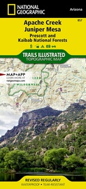
Wandelkaart 811 Angeles National Forest | National Geographic (9781566955775)
- ISBN / CODE: 9781566955775
- Editie: 01-08-2020
- Aantal blz.: 1
- Schaal: 1:80000
- Uitgever: National Geographic
- Soort: Wandelkaart
- Serie: Trails Illustrated Topographic Maps
- Taal: Engels
- Hoogte: 19.0 cm
- Breedte: 10.0 cm
- Gewicht: 91.0 g
- Bindwijze: -
- Uitvoering: Scheur- en watervast
- Schrijf als eerste een review
-
€ 17,95
Leverbaar in 3 - 5 werkdagen in huis in Nederland Levertijd Belgie
Gratis verzending in Nederland vanaf €35,-
-
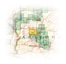
Overzicht Wandelkaarten California Trails Illustrated National Geographic
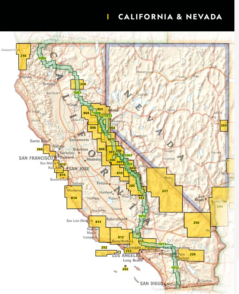
Producten op deze overzichtskaart:
Klik op een product om naar de pagina van dat product te gaan.
- Wandelatlas - Wandelkaart 1001 John Muir Trail | National Geographic
- Wandelkaart 1008 Pacific Crest Trail: Sierra Nevada North | National Geographic
- Wandelkaart - Topografische kaart 205 Sequoia - Kings Canyon National Parks | National Geographic
- Wandelkaart - Topografische kaart 206 Yosemite National Park | National Geographic
- Wandelkaart 218 Redwood National & State Parks | National Geographic
- Wandelkaart - Topografische kaart 221 Trails Illustrated Death Valley National Park | National Geographic
- Wandelkaart - Topografische kaart 226 Joshua Tree National Park | National Geographic
- Wandelkaart - Topografische kaart 256 Mojave National Preserve | National Geographic
- Wandelkaart 268 Lassen Volcanic National Park | National Geographic
- Wandelkaart - Topografische kaart 306 Yosemite SW - Yosemite Valley & Wawona | National Geographic
- Wandelkaart - Topografische kaart 307 Yosemite NW - Hetch Hetchy Reservoir | National Geographic
- Wandelkaart - Topografische kaart 308 Yosemite NE - Tuolumne Meadows and Hoover Wilderness | National Geographic
- Wandelkaart 309 Yosemite SE - Ansel Adams Wilderness | National Geographic
- Wandelkaart - Topografische kaart 803 Lake Tahoe Basin | National Geographic
- Wandelkaart 804 Tahoe National Forest West - Yuba & American Rivers | National Geographic
- Wandelkaart 805 Tahoe National Forest East - Sierra Buttes, Donner Pass | National Geographic
- Wandelkaart - Topografische kaart 809 Mammoth Lakes - Mono Divide - Inyo and Sierra National Forests | National Geographic
- Wandelkaart - Topografische kaart 810 Shaver Lake - Sierra National Forest | National Geographic
- Wandelkaart 811 Angeles National Forest | National Geographic
- Wandelkaart 812 Los Padres National Forest East | National Geographic
- Wandelkaart 814 Big Sur / Ventana Wilderness /CA | National Geographic
Overzichtskaarten
Beschrijving
Van de uitgever
National Geographic's Trails Illustrated map of Angeles National Forest provides both unmatched detail and valuable information for outdoor enthusiasts enjoying this diverse recreational area just north of Los Angeles. Expertly researched and created in partnership with the U.S. Forest Service, California State Parks and others, this map features key points of interest in the forest including Magic Mountain, Pleasant View Ridge, San Gabriel, Cucamonga and Sheep Mountain Wilderness Areas; San Gabriel Mountains; Pyramid Lake; and Piru Creek Wild and Scenic River. Also included are nearby California State Parks: Antelope Valley California Poppy Reserve, Ripley Desert Woodland, Castaic Lake State Recreation Area, Hungry Valley State Vehicular Recreation Area and Placerita Canyon.
Get off the beaten path and back on again by following the map along precisely mapped trails, labeled with mileage markers and color-coded according to designated use, whether hiking, mountain biking, ATVing or horseback riding. Highlighted are the nearly 200 miles of Pacific Crest Trail that wind through the area. Your navigation will be aided by the map's contour lines, elevations, labeled peaks and canyons, water features, and clear boundaries between national forest, wilderness and private land. Hundreds of recreation features are marked including areas for camping, fishing, swimming, climbing, canoeing, motor boating, skiing and winter recreation.
Every Trails Illustrated map is printed on "Backcountry Tough" waterproof, tear-resistant paper. A full UTM grid is printed on the map to aid with GPS navigation.
Other features found on this map include: Angeles National Forest, Arcadia, Azusa, Big Dalton Reservoir, Big Tujunga Canyon, Big Tujunga Reservoir, Bouquet Reservoir, Burbank, Castaic Lake, Chatsworth Reservoir, Cogswell Reservoir, Cucamonga Wilderness, Devils Gate Reservoir, Duarte, Glendale, Glendora, La Caada Flintridge, Lake Piru, Los Padres National Forest, Magic Mountain Wilderness, Mint Canyon, Monrovia, Morris Reservoir, Mount San Antonio, Mount Wilson, Palmdale, Pasadena, Piru Creek, Pleasant View Ridge Wilderness, Pyramid Lake, San Bernardino National Forest, San Dimas Reservoir, San Fernando, San Fernando Valley, San Gabriel Mountains, San Gabriel Reservoir, San Gabriel Wilderness, Santa Clarita, Santa Susana Mountains, Sespe Wilderness, Sheep Mountain Wilderness, Sierra Madre, Simi Valley, Soledad Canyon, Upper Van Norman Lake, West Fork San Gabriel River.
Reviews
Geen reviews gevonden voor dit product.
Schrijf een review
Graag horen wij wat u van dit artikel vindt. Vindt u het goed, leuk, mooi, slecht, lelijk, onbruikbaar of erg handig: schrijf gerust alles op! Het is niet alleen leuk om te doen maar u informeert andere klanten er ook nog mee!

