Wegenkaart - landkaart USA Rocky Mountains | ITMB (9781553410379)
- ISBN / CODE: 9781553410379
- Editie: 21-07-2014
- Druk: 1
- Aantal blz.: 1
- Schaal: 1:1000000
- Uitgever: ITMB
- Soort: Wegenkaart
- Taal: Engels
- Hoogte: 25.0 cm
- Breedte: 10.0 cm
- Gewicht: 53.0 g
- Uitvoering: Papier
- Schrijf als eerste een review
-
€ 13,95
Op voorraad. Voor 17.00 uur op werkdagen besteld, morgen in huis in Nederland Levertijd Belgie
Gratis verzending in Nederland vanaf €35,-
Beschrijving
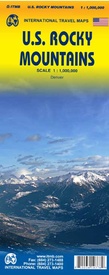
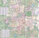
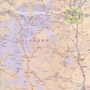
This is the latest American regional map that ITMB has published. This one covers Montana, Wyoming, Colorado, and parts of Idaho, New Mexico, and Arizona. It is, of course, the southern extension of the Canadian Rockies map through Blue Sky Montana and Mile High Denver. This is a double-sided map concentrating on roads and road quality, parks, touristic attractions, and urban areas. We feel that the state-by-state approach to mapping the USA just does not work well. With todays infrastructure and vehicular capability, one can pass through three or four states in a normal day drive.
Reviews
Geen reviews gevonden voor dit product.
Schrijf een review
Graag horen wij wat u van dit artikel vindt. Vindt u het goed, leuk, mooi, slecht, lelijk, onbruikbaar of erg handig: schrijf gerust alles op! Het is niet alleen leuk om te doen maar u informeert andere klanten er ook nog mee!


