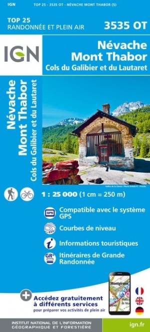
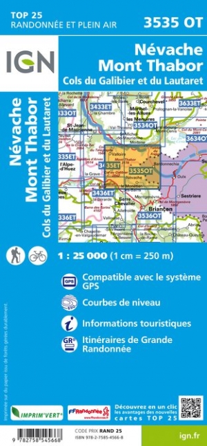
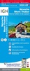
Wandelkaart - Topografische kaart 3535OT Névache - Mont Thabor | IGN - Institut Géographique National (9782758545668)
Cols du Galibier et du Lautaret
- ISBN / CODE: 9782758545668
- Editie: nieuwste editie
- Schaal: 1:25000
- Uitgever: IGN - Institut Géographique National
- Soort: Topografische kaart, Wandelkaart
- Serie: Top 25
- Taal: Frans
- Beoordeling: 4,6 ★★★★★ ★★★★★ (8 reviews) Schrijf een review
-
€ 16,95
Levertijd 2 - 4 werkdagen in huis in Nederland Levertijd Belgie
Gratis verzending in Nederland vanaf €35,-

.jpg)
-
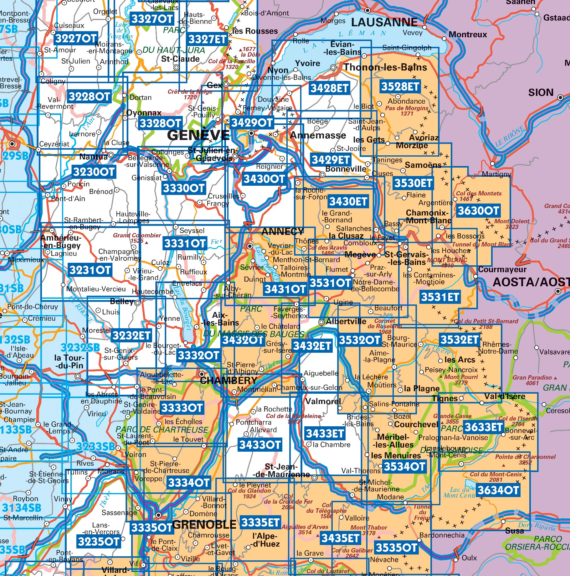
Topografische kaarten IGN 25.000 Savoie - Vanoise

Producten op deze overzichtskaart:
Klik op een product om naar de pagina van dat product te gaan.
- Topografische kaart - Wandelkaart 3233SB Le Grand-Lemps, Lac de Paladru, Voiron, Tullins | IGN - Institut Géographique National
- Wandelkaart - Topografische kaart 3333OT Massif de la Chartreuse Nord | IGN - Institut Géographique National
- Wandelkaart - Topografische kaart 3334OT Massif de la Chartreuse Sud | IGN - Institut Géographique National
- Wandelkaart - Topografische kaart 3335ET le Bourg d'Oisans - l'Alpe d'Huez | IGN - Institut Géographique National
- Wandelkaart - Topografische kaart 3335OT Grenoble | IGN - Institut Géographique National
- Wandelkaart - Topografische kaart 3335OTR Grenoble | IGN - Institut Géographique National
- Wandelkaart - Topografische kaart 3432ET Albertville | IGN - Institut Géographique National
- Wandelkaart - Topografische kaart 3432OT Massif des Bauges | IGN - Institut Géographique National
- Wandelkaart - Topografische kaart 3432OTR Massif des Bauges | IGN - Institut Géographique National
- Wandelkaart - Topografische kaart 3433ET Saint-Jean-de-Maurienne | IGN - Institut Géographique National
- Wandelkaart - Topografische kaart 3433OT Allevard | IGN - Institut Géographique National
- Wandelkaart - Topografische kaart 3435ET Valloire | IGN - Institut Géographique National
- Wandelkaart - Topografische kaart 3532ET les Arcs - la Plagne | IGN - Institut Géographique National
- Wandelkaart - Topografische kaart 3532OT Massif du Beaufortain | IGN - Institut Géographique National
- Wandelkaart - Topografische kaart 3534OT Les Trois Vallées | IGN - Institut Géographique National
- Wandelkaart - Topografische kaart 3535OT Névache - Mont Thabor | IGN - Institut Géographique National
- Wandelkaart - Topografische kaart 3633ET Tignes - Val d'Isère | IGN - Institut Géographique National
- Wandelkaart - Topografische kaart 3634OT Val Cenis | IGN - Institut Géographique National
-
Wandelkaarten IGN 25.000 Savoie - Vanoise

Producten op deze overzichtskaart:
Klik op een product om naar de pagina van dat product te gaan.
- Topografische kaart - Wandelkaart 3233SB Le Grand-Lemps, Lac de Paladru, Voiron, Tullins | IGN - Institut Géographique National
- Wandelkaart - Topografische kaart 3333OT Massif de la Chartreuse Nord | IGN - Institut Géographique National
- Wandelkaart - Topografische kaart 3334OT Massif de la Chartreuse Sud | IGN - Institut Géographique National
- Wandelkaart - Topografische kaart 3335ET le Bourg d'Oisans - l'Alpe d'Huez | IGN - Institut Géographique National
- Wandelkaart - Topografische kaart 3335OT Grenoble | IGN - Institut Géographique National
- Wandelkaart - Topografische kaart 3335OTR Grenoble | IGN - Institut Géographique National
- Wandelkaart - Topografische kaart 3432ET Albertville | IGN - Institut Géographique National
- Wandelkaart - Topografische kaart 3432OT Massif des Bauges | IGN - Institut Géographique National
- Wandelkaart - Topografische kaart 3432OTR Massif des Bauges | IGN - Institut Géographique National
- Wandelkaart - Topografische kaart 3433ET Saint-Jean-de-Maurienne | IGN - Institut Géographique National
- Wandelkaart - Topografische kaart 3433OT Allevard | IGN - Institut Géographique National
- Wandelkaart - Topografische kaart 3435ET Valloire | IGN - Institut Géographique National
- Wandelkaart - Topografische kaart 3532ET les Arcs - la Plagne | IGN - Institut Géographique National
- Wandelkaart - Topografische kaart 3532OT Massif du Beaufortain | IGN - Institut Géographique National
- Wandelkaart - Topografische kaart 3534OT Les Trois Vallées | IGN - Institut Géographique National
- Wandelkaart - Topografische kaart 3535OT Névache - Mont Thabor | IGN - Institut Géographique National
- Wandelkaart - Topografische kaart 3633ET Tignes - Val d'Isère | IGN - Institut Géographique National
- Wandelkaart - Topografische kaart 3634OT Val Cenis | IGN - Institut Géographique National
Overzichtskaarten
Beschrijving
Dit product heeft meerdere varianten:
Reviews
Geeft een goed en gedetailleerd overzicht van de omgeving, wandelpaden en plekken om te overnachten. Veel aan gehad tijdens het wandelen van de GR57/Tour du Mont Thabor!
★★★★★ door Renee 17 augustus 2023 | Heeft dit artikel gekochtVond u dit een nuttige review? (login om te beoordelen)
Gedetailleerde wandelkaart, noodzakelijk bij bergwandelingen. Sommige minder druk belopen paden staan er niet op.
★★★★★ door Marco van Schaik 10 september 2021 | Heeft dit artikel gekochtVond u dit een nuttige review? (login om te beoordelen)
Gebruiksvriendelijke kaart. Hoewel het goed staat aangegeven, toch regelmatig de kaart moeten bovenhalen. Nooit, zonder kaart op stap gaan!
★★★★★ door Isolde 28 september 2020Vond u dit een nuttige review? (login om te beoordelen)
Schrijf een review
Graag horen wij wat u van dit artikel vindt. Vindt u het goed, leuk, mooi, slecht, lelijk, onbruikbaar of erg handig: schrijf gerust alles op! Het is niet alleen leuk om te doen maar u informeert andere klanten er ook nog mee!
Ook interessant voor europa/frankrijk/franse-alpen
-

Wandelgids The GR5 Trail - The Alps
€ 26,95Wandelgidsen Franse Alpen -

Natuurgids Alpine Flowers - bloemeng
€ 15,95Natuurgidsen Duitse Alpen gebied -

Wandelkaart - Topografische kaart 36
€ 16,95Topografische kaarten Franse Alpen -

Scratch Map Alpine Cycle Climbs | Ma
€ 19,95Scratch Maps & kraskaarten Franse Alpen -

Wegenkaart - landkaart 333 Isere - S
€ 9,95Wegenkaarten Franse Alpen
Contactgegevens
T: +31 (0)50 - 3 12 69 50
E: info@dezwerver.nl
![]()
![]()
![]()
![]()
![]()
Bankgegevens
IBAN: NL11 RABO 0140 1961 88
BIC: RABONL2U
Kamer van Koophandel
Kvk: 75240440
BTW-nummer
NL 860203633 B01
BE 0541 545 456
Openingstijden
- Maandag13.00 - 18.00
- Dinsdag10.00 - 18.00
- Woensdag10.00 - 18.00
-
Donderdag10.00 - 18.00
(donderdagavond gesloten) - Vrijdag10.00 - 18.00
- Zaterdag10.00 - 17.00
- Zondaggesloten
Nieuwsbrief
Op de hoogte blijven van nieuwe reisgidsen, travelgadgets en kaarten? Geef u op voor onze nieuwsbrief. U ontvangt de nieuwsbrief 1x per maand.
Bekijk hier onze laatste nieuwsbrief:
Onze laatste Nieuwsbrief