Kaarten - Schotland
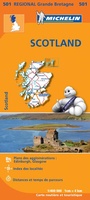 Wegenkaart - landkaart 501 Schotland | Michelin
Zoals je van Michelin mag verwachten zijn het onmisbare overzichtskaarten van een uitstekende kwaliteit: een duidelijk en goed leesbaar kaartbeeld. Vrijwel alle berijdbare wegen staan er op ingetekend, in kleur …
★★★★★★★★★★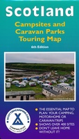 Camperkaart - Campinggids Scotland Campsites and Caravan Parks - Touring map | Scottishcamping.com
Dit soort kaarten zouden ze voor elk land moeten maken: heel duidelijk weergegeven vind je hier alle campings in Schotland op de voorzijde en op de achterzijde de adressen en …
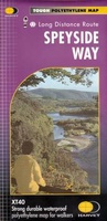 Wandelkaart Speyside Walk (Schotland) | Harvey Maps
Een bijzonder handige kaart van dit lange-afstands-wandelpad van 144 km. Op waterafstotend papier met veel details, uitstekend en voldoende voor deze route. A leap forward in technical excellence: Tough, durable …
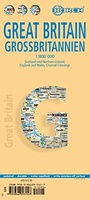 Wegenkaart - landkaart Groot - Brittannië | Borch
Mooie geplasticieerde kaart van Groot - Brittanië. Deze kaart biedt een goed overzicht van het land met detailkaarten. Our soft-laminated folded map of Great Britain shows: Scotland and Northern …
 Fietskaart The Ultimate UK Cycle Route Planner | Excellent Books
Fully updated and revised 4th edition for 2022 with an increased sheet size. One of the best selling UK cycle publications giving an overview of all the main signed UK …
★★★★★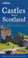 Wegenkaart - landkaart Castles map of Scotland - Schotland kastelen | Collins
Kaart waarop meer dan 700 kastelen in Schotland staan aangegeven. Explore Scotland’s ancient monuments with this pictorial map featuring over 700 castles and fortified houses. Includes an easy-to-use index listing …
★★★★★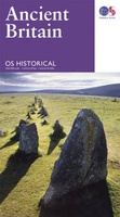 Wegenkaart - landkaart Ancient Britain | Ordnance Survey
The Ordnance Survey Ancient Britain map is a comprehensive guide to the most important archaeological sites of early English, Welsh and Scottish history. Ordnance Survey's Ancient Britain map shows Neolithic, …
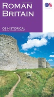 Wegenkaart - landkaart Roman Britain | Ordnance Survey
An informative map showing the location of the most important ancient monuments of Roman Britain. The map has been produced by Ordnance Survey in collaboration with the Ancient Monument Trusts …
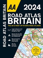 Wegenatlas Road Atlas Britain 2024 - A4 | AA Publishing
Wegenatlas, met spiraal, van Groot-Brittannie, Engeland, Wales en Schotland, met toeristische informatie This top-selling road atlas showcases Britain’s clearest mapping from the experts from the AA. Each page has been …
★★★★★ Wegenkaart - landkaart Schotland en Noord Engeland | Freytag & Berndt
Goede tweezijdige wegenkaart van het Noord Engeland en Schotland. Met register en enkele stadsplattegronden. De berijdbare wegen zijn goed weergeven, zowel de hoofdwegen als provinciale en lokale wegen; wegnummers worden …
 Wegenatlas Big Road Atlas Britain and Northern Ireland 2025 | A3 | Ringband | Collins
Grote wegenatlas, a3-formaat in ringband. The ultimate 3.2 miles to 1 inch scale large-format, spiral-bound road atlas of Britain, featuring Collins’ popular and well established road mapping, and designed for …
 Wegenkaart - landkaart Scotland - Schotland road map 2025 | Collins
Explore Scotland with easy-to-read mapping from Collins. Full-color map of Scotland at 8.7 miles to 1 inch (1:550.000), with clear road network and administrative areas shown in color. The map …
 Wegenkaart - landkaart Islay, Jura & Colonsay Tourist Map | Nicolson
Nicolson Digital Tourist Maps are ideal for planning your visit to some of the most beautiful areas of Scotland. Tourist attractions and places are clearly marked. Topography is shown through …
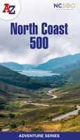 Wandelatlas Adventure Atlas North Coast 500 | A-Z Map Company
The A-Z Adventure Series of maps is the perfect companion for walkers, off-road cyclists, and anyone wishing to explore the great outdoors. The scenic North Coast 500 is one …
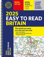 Wegenatlas Philip's Easy to Read Road Atlas of Britain 2025 | A4-Formaat | Ringband | Philip's Maps
"The detail you need at a size you can read". The latest 2025 Philip's Easy to Read Road Atlas of Britain from the best-selling Road Atlas range has over 350 …
 Wegenkaart - landkaart Grossbritannien, Irland - Groot Britannie, Ierland | Hallwag
Prima kaart van heel Groot Brittannie en Ierland , dubbelzijdig bedrukt met plaatsnamen index. Road map Great Britain / Ireland Road map with transit plans, location index, tourist information and …
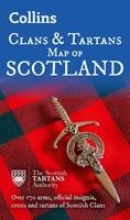 Historische Kaart Scotland Clans and Tartans Map | Collins
Prachtige kaart van Schotland waarin duideljk wordt welke cland er zijn geweest en nog zijn. Met een mooi overzicht van alle Tartans (Stoffen) die er aan gekoppeld zijn. Discover …
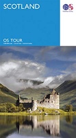 Wegenkaart - landkaart 12 Tour Map Scotland | Ordnance Survey
If you are on holiday and looking for a simple map containing all the information you need to make the most of your visit, the Tour maps are for you. …
★★★★★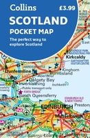 Wegenkaart - landkaart Pocket Map Scotland | Collins
Handy little full colour map of Scotland. Excellent value and very detailed for its size. Double-sided folded map with the Central Belt, southern Scotland and northern England on one side …
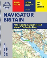 Wegenatlas Navigator Britain - Engeland en Schotland 1:100.000 | Philip's Maps
Bijzonder gedetaileerde wegenatlas van Engeland en Schotland op schaal 1:100.000 (met het noorden van Schotland 1:200.000). Alle wegen, bezienswaardigheden, National Trails, campings ... noem maar op en je vindt het …
★★★★★
- 1
- 2
- 3
- Volgende >>
- 4
Laatste reviews

Duidelijke kaart, ook met kleinere wegen. Snelle levering
★★★★★ door Ger Sulkers 02 mei 2024 | Heeft dit artikel gekocht
Ja wij zijn tevreden, alleen is mijn vriendin het boekje al kwijtgeraakt bij onze eerste wandeling.🙁
★★★★★ door Mark 02 mei 2024 | Heeft dit artikel gekocht
Ja ik ben dik tevreden over de wegenkaart van Kazachstan. Stond alles op wat ik wou dus heel erg tevreden daarover.
★★★★★ door Sjoerd Westra 02 mei 2024 | Heeft dit artikel gekocht
Zoals altijd mooie verzorgde kaarten die tijdens de reis van pas komen en achteraf mooie herinneringen oproepen.
★★★★★ door Klaas Wijnberg 02 mei 2024 | Heeft dit artikel gekocht