Wandelkaarten - Schotse Hooglanden & Speyside
Overzichtskaarten
-
Overzichtskaart Explorer 25.000 wandelkaarten Noord Schotland
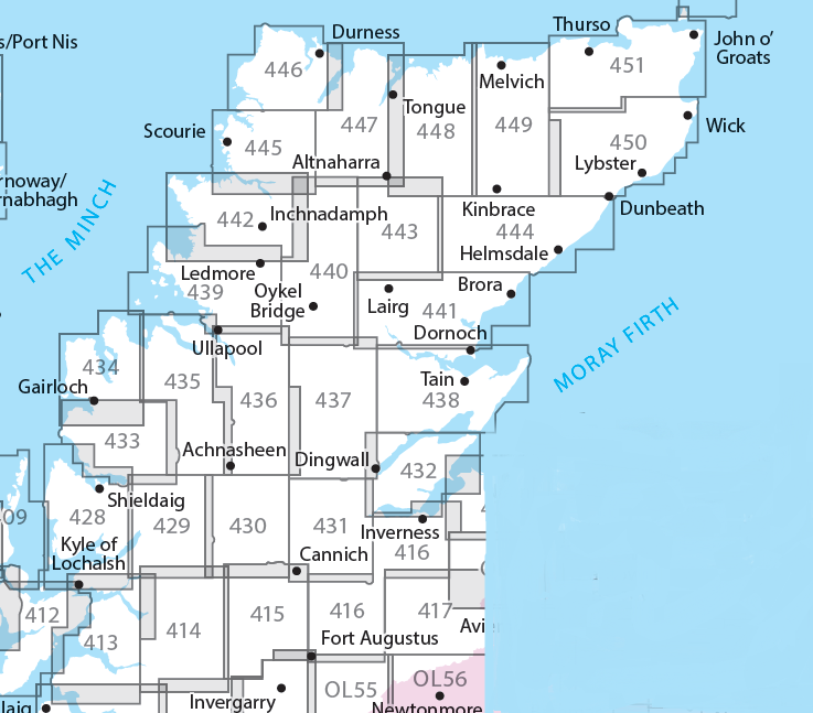
Producten op deze overzichtskaart:
Klik op een product om naar de pagina van dat product te gaan.
- Wandelkaart - Topografische kaart 416 OS Explorer Map Inverness, Loch Ness, Culloden | Ordnance Survey
- Wandelkaart - Topografische kaart 428 OS Explorer Map Kyle of Lochalsh, Plockton, Applecross | Ordnance Survey
- Wandelkaart - Topografische kaart 429 OS Explorer Map Glen Carron, West Monar | Ordnance Survey
- Wandelkaart - Topografische kaart 430 OS Explorer Map Loch Monar, Glen Cannich, Glen Strathfarrar | Ordnance Survey
- Wandelkaart - Topografische kaart 431 OS Explorer Map Glen Urquhart, Strathglass | Ordnance Survey
- Wandelkaart - Topografische kaart 432 OS Explorer Map Black Isle | Ordnance Survey
- Wandelkaart - Topografische kaart 433 OS Explorer Map Explorer Torridon - Beinn Eighe & Liathach | Ordnance Survey
- Wandelkaart - Topografische kaart 434 OS Explorer Map Gairloch / Loch Ewe | Ordnance Survey
- Wandelkaart - Topografische kaart 435 OS Explorer Map An Teallach / Slioch | Ordnance Survey
- Wandelkaart - Topografische kaart 436 OS Explorer Map Beinn Dearg, Loch Fannich | Ordnance Survey
- Wandelkaart - Topografische kaart 437 OS Explorer Map Ben Wyvis, Strathpeffer | Ordnance Survey
- Wandelkaart - Topografische kaart 438 OS Explorer Map Dornoch, Tain | Ordnance Survey
- Wandelkaart - Topografische kaart 439 OS Explorer Map Coigach, Summer Isles | Ordnance Survey
- Wandelkaart - Topografische kaart 440 OS Explorer Map Glen Cassley, Glen Oykel | Ordnance Survey
- Wandelkaart - Topografische kaart 441 OS Explorer Map Lairg, Bonar Bridge, Golspie | Ordnance Survey
- Wandelkaart - Topografische kaart 442 OS Explorer Map Assynt, Lochinver | Ordnance Survey
- Wandelkaart - Topografische kaart 443 OS Explorer Map Ben Kilbreck, Ben Armine | Ordnance Survey
- Wandelkaart - Topografische kaart 444 OS Explorer Map Helmsdale, Strath of Kildonan | Ordnance Survey
- Wandelkaart - Topografische kaart 445 OS Explorer Map Foinaven, Arkle, Kylesku, Scourie | Ordnance Survey
- Wandelkaart - Topografische kaart 446 OS Explorer Map Durness, Cape Wrath | Ordnance Survey
- Wandelkaart - Topografische kaart 447 OS Explorer Map Ben Hope, Ben Loyal, Kyle of Tongue | Ordnance Survey
- Wandelkaart - Topografische kaart 448 OS Explorer Map Strath Naver & Loch Loyal | Ordnance Survey
- Wandelkaart - Topografische kaart 449 OS Explorer Map Strath Halladale & Strathy Point | Ordnance Survey
- Wandelkaart - Topografische kaart 450 OS Explorer Map Wick, The Flow Country | Ordnance Survey
- Wandelkaart - Topografische kaart 451 OS Explorer Map Thurso, John o' Groats | Ordnance Survey
-
Overzichtskaart Explorer 25.000 wandelkaarten Noordoost Schotland - Cairngorms
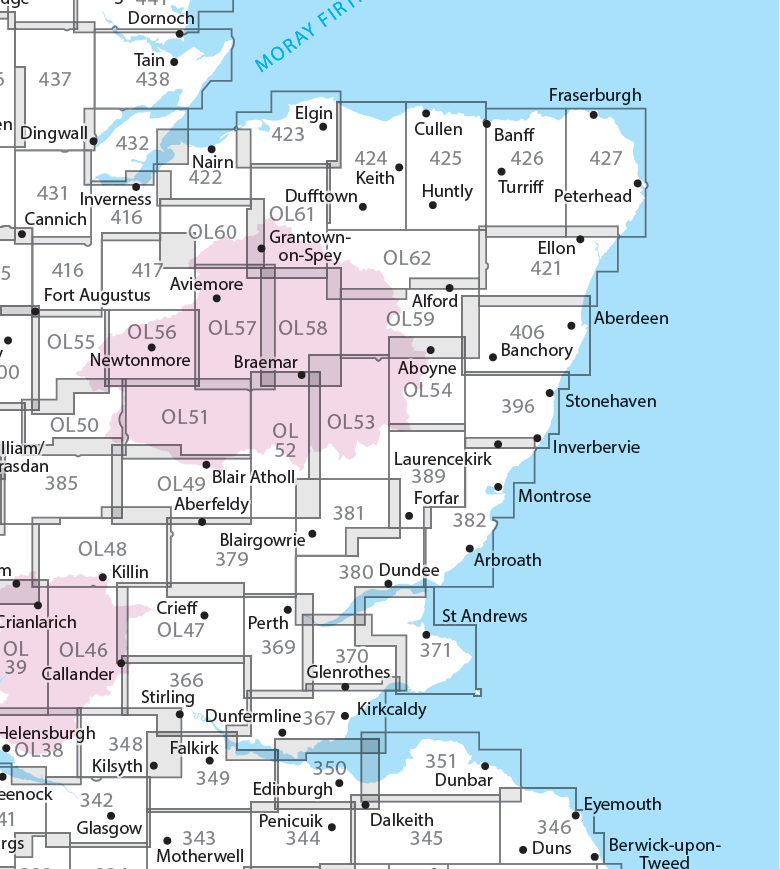
Producten op deze overzichtskaart:
Klik op een product om naar de pagina van dat product te gaan.
- Wandelkaart - Topografische kaart 342 OS Explorer Map Glasgow | Ordnance Survey
- Wandelkaart - Topografische kaart 348 OS Explorer Map Campsie Fells | Ordnance Survey
- Wandelkaart - Topografische kaart 349 OS Explorer Map Falkirk, Cumbernauld, Livingston | Ordnance Survey
- Wandelkaart - Topografische kaart 350 OS Explorer Map Edinburgh | Ordnance Survey
- Wandelkaart - Topografische kaart 351 OS Explorer Map Dunbar, North Berwick | Ordnance Survey
- Wandelkaart - Topografische kaart 366 OS Explorer Map Stirling, Ochil Hills West | Ordnance Survey
- Wandelkaart - Topografische kaart 367 OS Explorer Map Dunfermline, Kirkcaldy, Glenrothes South | Ordnance Survey
- Wandelkaart - Topografische kaart 369 OS Explorer Map Perth, Kinross | Ordnance Survey
- Wandelkaart - Topografische kaart 370 OS Explorer Map Glenrothes North, Falkland, Lomond Hills | Ordnance Survey
- Wandelkaart - Topografische kaart 371 OS Explorer Map St-Andrews, East Fife | Ordnance Survey
- Wandelkaart - Topografische kaart 379 OS Explorer Map Dunkeld, Aberfeldy, Glen Almond | Ordnance Survey
- Wandelkaart - Topografische kaart 380 OS Explorer Map Dundee, Sidlaw Hills | Ordnance Survey
- Wandelkaart - Topografische kaart 381 OS Explorer Map Blairgowrie, Kirriemuir, Glamis | Ordnance Survey
- Wandelkaart - Topografische kaart 382 OS Explorer Map Arbroath, Montrose, Carnoustie | Ordnance Survey
- Wandelkaart - Topografische kaart 385 OS Explorer Map Rannoch Moor, Ben Alder | Ordnance Survey
- Wandelkaart - Topografische kaart 389 OS Explorer Map Forfar, Brechin, Edzell | Ordnance Survey
- Wandelkaart - Topografische kaart 396 OS Explorer Map Stonehaven, Inverbervie & Laurencekirk | Ordnance Survey
- Wandelkaart - Topografische kaart 406 OS Explorer Map Aberdeen, Banchory | Ordnance Survey
- Wandelkaart - Topografische kaart 416 OS Explorer Map Inverness, Loch Ness, Culloden | Ordnance Survey
- Wandelkaart - Topografische kaart 417 OS Explorer Map Monadhliath Mountains North, Strathdearn | Ordnance Survey
- Wandelkaart - Topografische kaart 421 OS Explorer Map Ellon & Inverurie, explorer | Ordnance Survey
- Wandelkaart - Topografische kaart 422 OS Explorer Map Nairn, Cawdor | Ordnance Survey
- Wandelkaart - Topografische kaart 423 OS Explorer Map Elgin, Forres, Lossiemouth | Ordnance Survey
- Wandelkaart - Topografische kaart 424 OS Explorer Map Buckie, Keith | Ordnance Survey
- Wandelkaart - Topografische kaart 425 OS Explorer Map Huntly, Cullen | Ordnance Survey
- Wandelkaart - Topografische kaart 426 OS Explorer Map Banff, Macduff, Turriff | Ordnance Survey
- Wandelkaart - Topografische kaart 427 OS Explorer Map Peterhead, Fraserburgh | Ordnance Survey
- Wandelkaart - Topografische kaart 431 OS Explorer Map Glen Urquhart, Strathglass | Ordnance Survey
- Wandelkaart - Topografische kaart 432 OS Explorer Map Black Isle | Ordnance Survey
- Wandelkaart - Topografische kaart OL46 OS Explorer Map The Trossachs | Ordnance Survey
- Wandelkaart - Topografische kaart OL47 OS Explorer Map Crieff, Comrie & Glen Artney | Ordnance Survey
- Wandelkaart - Topografische kaart OL48 OS Explorer Map Ben Lawers & Glen Lyon | Ordnance Survey
- Wandelkaart - Topografische kaart OL49 OS Explorer Map Pitlochry & Loch Tummel | Ordnance Survey
- Wandelkaart - Topografische kaart OL50 OS Explorer Map Ben Alder, Loch Ericht & Loch Laggan | Ordnance Survey
- Wandelkaart - Topografische kaart OL51 OS Explorer Map Atholl | Ordnance Survey
- Wandelkaart - Topografische kaart OL52 OS Explorer Map | Active Glen Shee - Braemar | Ordnance Survey
- Wandelkaart - Topografische kaart OL53 OS Explorer Map Lochnagar, Glen Muick & Glen Clova | Ordnance Survey
- Wandelkaart - Topografische kaart OL54 OS Explorer Map Glen Esk & Glen Tanar | Ordnance Survey
- Wandelkaart - Topografische kaart OL55 OS Explorer Map Loch Laggan & Creag Meagaidh | Ordnance Survey
- Wandelkaart - Topografische kaart OL56 OS Explorer Map Badenoch & Upper Strathspey | Ordnance Survey
- Wandelkaart - Topografische kaart OL57 OS Explorer Map Cairn Gorm & Aviemore | Ordnance Survey
- Wandelkaart - Topografische kaart OL58 OS Explorer Map Braemar, Tomintoul & Glen Avon | Ordnance Survey
- Wandelkaart - Topografische kaart OL59 OS Explorer Map Aboyne, Alford & Strathdon | Ordnance Survey
- Wandelkaart - Topografische kaart OL60 OS Explorer Map Lochindorb, Grantown-on-Spey & Carrbridge | Ordnance Survey
- Wandelkaart - Topografische kaart OL61 OS Explorer Map Grantown-on-Spey & Hills of Cromdale | Ordnance Survey
- Wandelkaart - Topografische kaart OL62 OS Explorer Map Coreen Hills & Glenlivet | Ordnance Survey
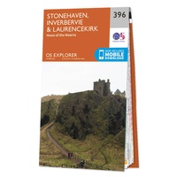 Wandelkaart - Topografische kaart 396 OS Explorer Map Stonehaven, Inverbervie & Laurencekirk | Ordnance Survey
Met zijn 4cm voor 1 km (2 ½ cm voor 1 mijl) schaal, is de OS Explorer kaartenserie de ideale en meest gedetailleerde kaartenreeks voor mensen die graag outdoor-activiteiten zoals …
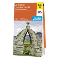 Wandelkaart - Topografische kaart OL54 OS Explorer Map Glen Esk & Glen Tanar | Ordnance Survey
Een van de beste detailkaarten die er op de wereld gemaakt worden: zeer gedetailleerd, prachtig helder kleurgebruik, veel topografische aspecten en - zeer belangrijk - allerlei toeristische en recreatieve aspecten …
 Wandelkaart John O'Groats trail | Harvey Maps
Mooie, duidelijke kaart van de John O'Groats trail in Schotland. Geplastificeerd met veel extra informatie en uitsnedes van de route. The John o' Groats Trail is a 237 km (147 …
★★★★★★★★★★ Wandelkaart Cape Wrath Trail North | Harvey Maps
Een bijzonder handige kaart van dit lange-afstands-wandelpad. Op waterafstotend papier met veel details. Het enige dat je eigenlijk een beetje mist is een overzicht. Verder uitstekend en voldoende voor de …
 Wandelkaart Cape Wrath Trail South | Harvey Maps
Een bijzonder handige kaart van dit lange-afstands-wandelpad. Op waterafstotend papier met veel details. Het enige dat je eigenlijk een beetje mist is een overzicht. Verder uitstekend en voldoende voor de …
★★★★★ Wandelkaart 57 OS Explorer Map | Active Cairn Gorm, Aviemore ACTIVE | Ordnance Survey
Met zijn 4cm voor 1 km (2 ½ cm voor 1 mijl) schaal, is de OS Outdoor Leisure kaartenserie de ideale en meest gedetailleerde kaartenreeks voor mensen die graag outdoor-activiteiten …
★★★★★ Wandelkaart Assynt & Coigach | Harvey Maps
"This is a fabulous map for a fabulous area; for the first time it shows crags, bouldering areas and clear details in what could seem a maze of rock and …
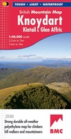 Wandelkaart Knoydart / Kintail & Glen Affric | Harvey Maps
"Clarity is the hallmark of this map. It covers magnificently honed peaks set above western seas and lochs, inviting exploration of one of Scotland's superlative and remote mountain regions", the …
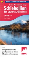 Wandelkaart Schiehallion / Ben Lawers & Glen Lyon | Harvey Maps
"I've spent most of my climbing career searching for new crags and bouldering areas and until Harvey Maps came along it was a process of trial and error. Their attention …
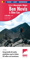 Wandelkaart Ben Nevis & Glen Coe | Harvey Maps
"This excellent Ben Nevis and Glen Coe map provides all the details needed for safe navigation on these iconic mountains". Cameron McNeish, outdoor writer and broadcaster. Detailed map for …
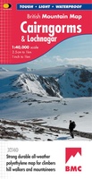 Wandelkaart Cairngorms & Lochnagar | Harvey Maps
"Inspiring map of much of Scotland's newest National Park with masses of information for walkers, mountain bikers and mountaineers. And it is virtually indestructible." Nigel Williams, Head of Training, Glenmore …
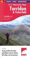 Wandelkaart Torridon & Fisherfield | Harvey Maps
"HARVEY British Mountain Maps are a joy to use. The detail and accuracy make them my first choice when I am researching a route or just out on the hills …
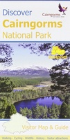 Wandelkaart Discover Cairngorms National Park | Footprint maps
Since it was created in 2003 the Cairngorms National Park has provided the ultimate destination for visitors in the UK wanting to experience a unique mixture of wilderness and cultural …
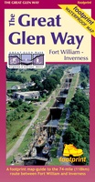 Wandelkaart The Great Glen Way | Footprint maps
The complete map/guide of both routes between Fort William and Inverness. Also contains compact and concise practical information for walkers. For every copy of this map sold, a …
 Wandelkaart Jura - Schotland | Harvey Maps
Shows the Paps of Jura and includes 1 Corbett and 2 Grahams. This detailed map for hillwalkers shows the whole of the Isle of Jura at the popular 1:25,000 …
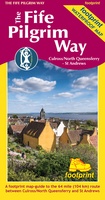 Wandelkaart The Fife Pilgrim Way | Footprint maps
A handy, waterproof map breaking down the Fife Pilgrim Way into seven sections. The Fife Pilgrim Way runs between North Queensferry or Culross and St Andrews. It is designed as …
 Wandelkaart The Great Trossachs Path | Harvey Maps
Een bijzonder handige kaart van dit lange-afstands-wandelpad. Op waterafstotend papier met veel details. Het enige dat je eigenlijk een beetje mist is een overzicht. Verder uitstekend en voldoende voor de …
 Wandelkaart Torridon | Harvey Maps
Een bijzonder handige kaart van dit gebied. Op waterafstotend papier met veel details. ncludes Slioch, Beinn Eighe, Liathach and Beinn Alligin. Detailed map for hillwalkers of the Torridon Hills …
 Wandelkaart Ben Alder | Harvey Maps
Superwalker is designed to be the most practical tool for navigation outdoors. The Superwalker XT25 is based on original HARVEY mapping with all the information a walker would expect on …
 Wandelkaart Fannichs Seana Bhraigh & Ben Wyvis | Harvey Maps
Detailed map for hillwalkers of the Fannichs ridge at the popular 1:25,000 scale. This is an area located to the south of Ullapool and to the west of Dingwall. Includes …
Laatste reviews

Heb de gids cadeau gedaan en die persoon was er heel blij mee ..
★★★★★ door J 21 november 2024 | Heeft dit artikel gekocht
De kaart van Kirgystan is prachtig, zeer gedetailleerd. Kan niet wachten tot de we echt op reis hmgaan die kant op.
★★★★★ door Marijke Eering 21 november 2024 | Heeft dit artikel gekocht
Super handig fiets boekje en mooi water bestendig. En handig om op de kaarten te kijken heel duidelijk beschrijving. Wij fietsen al jaren in Duitsland …
★★★★★ door Jenneke holterman 19 november 2024 | Heeft dit artikel gekocht
prima kaart levering en betaling allemaal vlot verlopen
★★★★★ door Marc Buts 19 november 2024 | Heeft dit artikel gekocht

